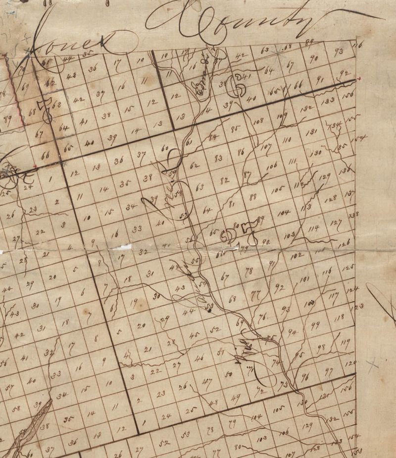
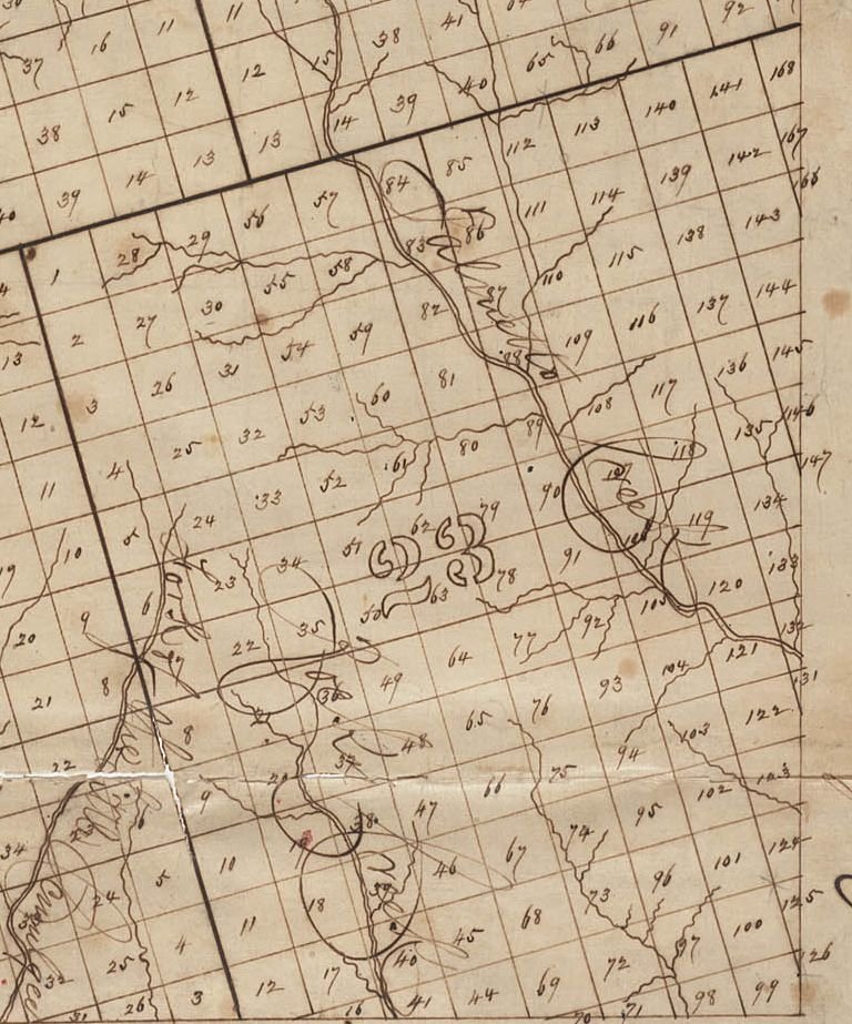
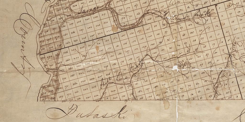
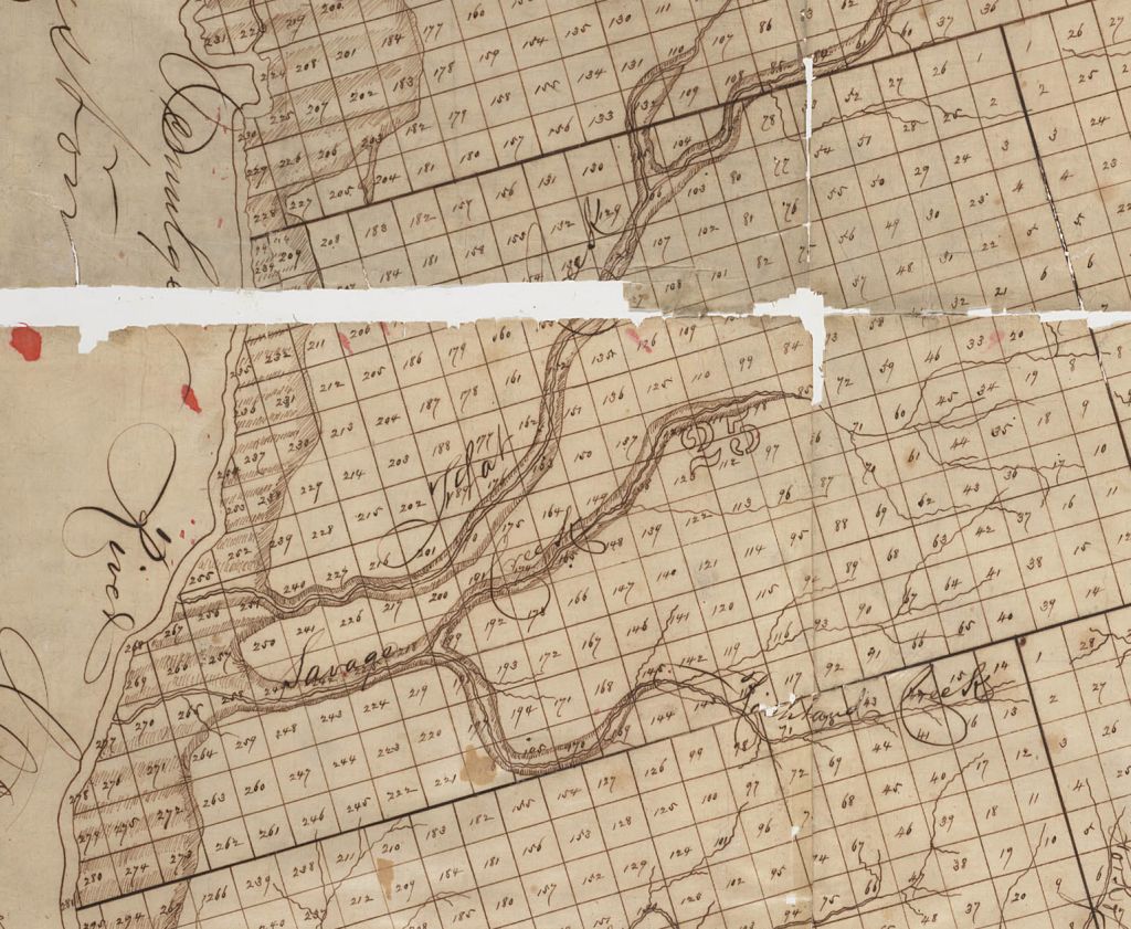
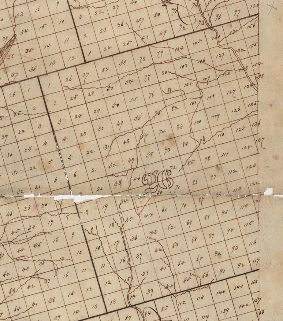
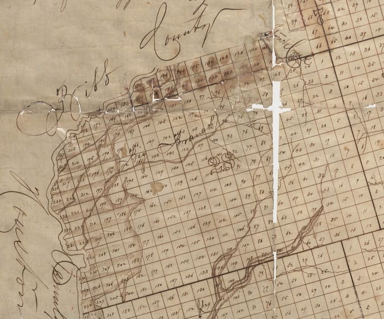
| 6 | 7 | 23 | 24 | 25 | 26 | 27 | 28 |
| Name, Date, Etc. |
| Robins Andrews, numerous lots, 1800-2000 acres, 1844 |
| Lavinia
N. Brooks estate, 405 acres, 1853 |
| G. W. Bryan. Plantation between Flat Creek and Savage Creek, 1200 acres, 1862 |
| Stephen S. Bryom estate 1817 |
| Joseph Collins Estate, formerly the Welch place, 300 acres, 1840 |
| Lewis Daniel Estate, adj Oliver and Edwards 1827 |
| Barbaray Deshazo Estate, where William Dennard lived, 400 acres, 1828 |
| Floyd A. Finch 300 acres of land, more or less, Nos. not known, bounded by C. R. Faulk and Robert Paul; and 287 acres, Nos. not known, bounded by Mrs. Kelly and T. Cook, 587 acres, 1872 |
| John Forsyth, Plantation for sale, between Ocmulgee and Flat Creek, 4000 acres, 1849 |
| E. Hamilton , 1,475 acres, 1841 |
| Robert Iverson estate , on Stone Creek, Lot 213, 202 1/2 acres, 1817 |
| Susannah Jacobs estate,Flat Creek, adj Jacob Pierce, Lot 106, 101 1/4 acres, 1828 |
| Henry Jemison, 4 adjoining lots, on Turkey Creek, 810 acres, 1816 |
| G H Jordan estate, 2 miles from Buzzard Roost, 1,415 acres, 1856 |
| John A. McCrea, adminstrator of Gustavus McCrea, bounded by Tarver and Brother, M. E. Slappy, M. E. Carter, J. J. Hodges, R. R, Slappey, Jr, A. M. Smith, 183 acres, 1872 |
| Thomas Napier Estate swampland on Ocmulgee, part of 572 acres, 1839 |
| John Parker Estate, 1,700 acres, 1853 |
| Harmon Perryman 1833 |
| Daniel W. Shine estate, 3,000 acres, 1869 |
| Collin Sledge Estate , adj Dennard, Wimberly, Lowry, 130 acres 1828 |
| George Spann half of the tract of land, 101 1/2 acres, 1812 |
| Stephen Stephens estate, on Shellstone creek, 101 1/4 acres, 1817 |
| Thomas W. Stewart estate, on river road to Macon, 1,000 acres 1854 |
| C.A. Tharpe estate, adj Burkett, Nelson, Lot 5, 202 1/2 acres, 1872 |
| J.H.R. Washington, between Brunswick Railroad and Ocmulgee, 1,400 acres, 1865 |
| Name, Date, Etc. | Lot | Acres |
| A. L. Maxwell, 1873 | 11 | 202½ |
| A. L. Maxwell, 1873 | 16 | 101¼ |
| A. L. Maxwell, 1873 | 17 | 202½ |
| A. L. Maxwell, 1873 | 37 | 202½ |
| Name, Date, Etc. | Lot | Acres |
| Phillip R. Jessup estate, Plantation
where William S. C. Jessup now lives,
adj. Abram Williams, Thomas C. McGough 1846, Macon Weekly Telegraph |
? | 300 |
| Sarah Young Est., adj James Artapee, others, head of Stone Crk 1838 | ? | 202½ |
| A. L. Maxwell 1874 | 10
11 |
202½
202½ |
| Jackson Russell 1812 | 43 | 202½ |
| Elisha Davis, land was formerly in Baldwin County, then Twiggs, then Bibb in 1851 | 62 | 202½ |
| Jermiah Busbee 1819 The Journal (link) 1877 became part of Bibb County | 63 | 202½ |
| 1877 became part of Bibb County | 64 | 202½ |
| The Newark Insurance and Banking Company, lot, 1849 | 66 | 202½ |
| The Newark Insurance and Banking Company, lot, 1849 | 67 | 202½ |
| The Newark Insurance and Banking Company, lot, 1849 | 78 | 202½ |
| The Newark Insurance and Banking Company, lot, 1849 | 89 | 50, 155 |
| The Newark Insurance and Banking Company, lot, 1849 | 90 | 202½ |
| The Newark Insurance and Banking Company, lot, 1849 | 91 | 150 |
| Robert Lyons & Benjamin Brown 1815 | 108 | 202½ |
| Orphans of John Freeny, 1811 | 111 | 202½ |
| Andrew Creighton, 1816 | 121 | 202½ |
| Abisha Andrews estate, the home place, 1869 | 135 | 100 |
| Abisha Andrews estate, swamp land, 1869 | 146 | 10 |
| Joseph Brady estate, fraction, 1817 | 163 | 29 |
| Isaac Young estate 1861 | 411 | 101¼ |
| Name, Date, Etc. | Lot . | Acres |
| 1818 Twiggs County Tax Digest Index: Captain
Ellis District (#23)
- Artimus Ward - Shadrack Ward (contributed by Melanie Ward 5th gr-granddaughter of Shadrach Ward Sr b abt 1760) |
na | na |
| William Crocker Plantation, adj Faulk & Solomon, near Marion 1872 | na | three 202½ |
| Andrew Creighton 1816 | 2 | 202½ |
| Thomas Napier Estate 1839 | 8 | part of 572 |
| William Tait lease 1812 | 24 | 202½ |
| Theophilus Sauls Estate 1872 | 26
27 |
202½
50 |
| Theophilus Sauls Estate 1872 | 30
31 |
202½
16 |
| Anderson Comer estate 1816; Robert Goode, 101 1/4 acre, 1820 | 33 | |
| Andrew Creighton 1816 | 35 | 1/4 part of |
| Abraham Wells 1812
Wilson Warren 1812 |
46
46 |
1/2 lot
1/2 lot |
| Hardy Pace 1844 | 47 | 1/2 lot |
| Jacob & Littleton Tison 1820 | 48 | 1 lot |
| William Berryhill The Journal (link) | 51 | 202½ |
| Jacob & Littleton Tison 1820 | 64 | 1 lot |
| Centuary Roe 1830 | 69 | 202½ |
| Mark Williams, part of 90 acres | 72 | 202 1/2 |
| Mark Williams 1819 The Journal | 75 | 202½ |
| Silas Wood 1816 | 84 | 101¼ |
| Patience Ecols 1816; Mark Williams, part of 90 acres | 92 | 202 1/2 |
| William Tait, 2 yr lease 1812 | 94 | - |
| James Griffin 1810 | 121 | 202½ |
| Arthur Youngblood
Hancock Co. Ga Taxpayers 1812 |
133 | 202½ (pt. in Wilkinson) |
| Joseph B. Jones 1815 | 143 | 102½ |
| John Turner 1816 | 190 | 101¼ |
| Watson Mitchell 1816 | 221 | 202½ |
| F. Walker 1819 | 262 | 202½ |
| Name, Date, Etc. | Lot | Acres |
| Frederick R. Tarver estate, includes Buzzard Roost ferry, 1857 | - | 1200 |
| Joah Tison. Godfrey Ross estate 1829 | ? | 81 |
| Green B. Johnson 1871, 1872 | - | 130 |
| Isaac Mitchell, adj. R. Smith | ? | 122+ |
| W. J. Hodges, old James Bryan place adj McCrea, Slappy, Carter, Coley 1874 | ? | 550 |
| Peter Funderburke 1816 | 16 | 101¼ |
| Randle Henderson1810 | 24 | 202½ |
| Shadrack Moore 1816 | 25 | 202½ |
| J. M. Ware estate 1872 | 34 | part of 405 A. |
| John Bennison 1816.
J. M. Ware estate 1872 |
41 | 86¼
part of 405 A. |
| Joseph Hasty Estate, adjoins Donaldson,
Coley, John Barnes, Thomas Westbrooke est,
Randle Henderson 1810 |
44
45 |
101¼
Lot |
| John Morgan 1815 | 62 | 202½ |
| Samuel Ward 1815
John Edwards 1816 |
73 | 101¼ |
| F. A. Finch, adj. Faulk, Solomon, Bullard 1874 | 83 | 101¼ |
| Luke Bozeman estate. 1814 | 92 | lot |
| William Stinson estate, 1816 | 98 | lot |
| John Smith, sheriff's sale, 1816 | 118 | 101¼ |
| Lewis Daniel 1815 | 125 | 202½ |
| Dennis L. Ryan 1809 | 129 | lot |
| Newman Rogers heirs, adj lands of Mrs, Lucy Andrews, Wm. Andrews, heirs of Newman Eogers 1865-1866 | 135 | 202½ |
| Dennis L. Ryan 1809 | 140 | lot |
| Ebenezer Ellis for use of Thomas M'Griff, 1816 | 172 | one half |
| James Combes to William Gilbert 1828 Combs Family (link) | 196
197 |
405 As
comb w/197 |
| Henry Carter, part of 843 acres, 1873 | 200 | 182½ |
| Elijah Ward Estate. adj Thornton Perry 1828 | 207 | 101¼ |
| Lewis Smith, John York, Joseph B. Johnson, James Smith, Burwell Smith, John Adcock 1808 | 212 | 202½ |
| Jesse Fulgram 1816
Robert Craig orphans 1817 |
215 | 202½ |
| John A. McCrea, adminstrator of Gustavus McCrea, bounded by Tarver and Brother, M. E. Slappy, M. E. Carter, J. J. Hodges, R. R, Slappey, Jr, A. M. Smith 1872 | - | 181 |
| Henry Carter, bounded by lands of estate of Gustavus McCrea, M. E. Slappy, J. Marchman and Mrs. M. E. Carter, 1873 | 110 | |
| Edward
Hogan 1812
Henry Carter 1873 |
232
232 |
202½
75 |
| Henry Carter, part of 843 acres,
1873
Georgia Roan 1810 |
261
262 |
202½
202½ |
| Richard Smith Estate 1826 | 269 | 202½ |
| Peter Fountain 1816; Richard Smith Estate 1826 | 270 | 202½ |
| Hardy
Fulgham heirs, Cader Fairchild, adm'r in right of his wife. 1818
Henry Carter bounded by estate of Gustavus McCrea, M. E. Slappy, Twiggs and Pulaski line, and estate of B. Jordan. 1873 |
272 | 202½ |
| Henry Carter, part of 843 acres, 1873 | 273 | 68¼ |
| Lewis Daniel 1817 | 288 | |
| Richard Smith Estate 1826 | 291 | 39 |
| Richard Smith Estate 1826 | 292 | 130 |
| Richard Smith Estate, part of 68 acres, 1826 | 296 | part |
| Richard Smith Estate, part of 68 acres, 1826 | 296 | part |
| Elizabeth Wynn 1810 Land Grant | 575 | 202½ |
| Name, Date, Etc. | Lot | Acres |
| Catherine A. Bunn, bounded by F. D. Wimberly, G. W. Faulk, F. D. Wimberly, Jr., Richland Creek, known as the Pace place. 1879 - 1881 | ? | 405 |
| Floyd A. Finch/Floyd House Hotel 1872 house and lot in Jeffersonville | ? | NA |
| Robert
F. Averitt 1872 bounded by lands ofT. S. Jones, James T. Glover,
estate of Wm. S. Kelly and F. A. Finch. |
? | 405 acres |
| William Crocker plantation 1872 3 lots each 202½ acres near Marion, lands of Wm. Faulk, Charles Faulk, Wm. Solomon | ? | 607½ |
| G. W. Bryan 1220 acres for sale between Flat Creek & Savage Creek 1862 | ? | 1220 |
| William Robertson1256 1/4 acres swamp land, Ocmulgee; 8?6 pine land 1815 | 2062+ | |
| Josiah Irvin 1810 | ? | 202½ |
| Matthew W. Little estate 1874 | ? | 66 |
| E. Wimberly estate 1872 | 5
7 8 |
100
202½ 100 |
| Andrew Creighton 1816; James Radford, adj Jones, Ward, Bryan, Wimberly 1874 | 11 | 202½ |
| James Lyon 1810 | 21 | 202½ |
| David Bates 1815; Phillip Cook 1816 | 25 | 202½ |
| Josiah Irvin 1810 | 29 | 202½ |
| Mary Staton Estate 1816; William A. Crumpton parts of lots Nos. 45, 47 & 33, cont. 423 Ac, 1844 | 33 | 202½ |
| William A. Crumpton parts of lots Nos. 45, 47 & 33, cont. 423 acres, 1844 | 45 | part |
| William A. Crumpton parts of lots Nos. 45, 47 & 33, cont. 423 acres, 1844 | 47 | part |
| John Mock 1811 | 59 | 202½ |
| Elijah Funderburke, 50 acres 1816; John
Busby, 50 acres 1816
Francis Spann 152½ 1816 |
66
66 |
50
152½ |
| Town of Marion 1810 Acts | 73 | ? |
| Robert L. Perryman 1827 | 73 | ? |
| John N. Oglethorpe 1812,
half acre town lot 1813 Ga.
Journal & Macon Messenger (link)
Timothy Bruin 1815 |
73 | Town Lt 2 |
| Britton Griffin 1812 | 73 | Lot |
| Augustus A. Collins, 1 acre lot Jeffersonville, adj. Ellis Long's , where John H. Denson lives, 1851 | 73 | Lot 4 |
| John S. Rickets foreclosure, 1 half acre lot, 1812 | 73 | Lot 5 |
| Thomas Smith, one half of lot 7. 1812 | 73 | Lot 7 |
| John N Oglethorpe, lot, 1813 |
73 | Lot 9 |
| William R Jones, lot in Marion, 1812; William R. Jones and William Nelson 1815 | 73 | Lot 10 |
| Anna Hughes, 1/2 lot in Marion 1816 | 73 | Lot 18 |
| Joseph Sawyer, lot in Marion, 1839 | 73 | 40 |
| John Barton Estate, lot in Marion, 1837 | 73 | - |
| William Barnes 1816 | 82 | - |
| Henry Rouse, part of 303 3/4 acres, 1820 | 93 | 202½ |
| Henry Rouse, part of 303 3/4 acres, 1820 | 94 | 202½ |
| William Nelson 1815 | 96 | 1/2 lot |
| A.Davis estate , Asa Cotton & Hardy Lashley1815; Abraham Davis 1815 | 97 | 202½ |
| Samuel Powell (1) Samuel Powell (2), lease, 1812 | 99 | 202½ |
| James Wheeler 1816 | 105 | - |
| Susannah
Jacobs Estate.
101½ 1828
Thomas Dozier Estate 100 1849 |
106 | 101½
100 |
| Alston Massey 1812 | 115 | 101½ |
| John King. Henry Crittenton 1816 | 125 | 202½ |
| Thomas Dozier Estate 1849 | 128 | 100 |
| Joseph Vaser Estate 1816 | 142 | |
| Phillip Cook, 1 lot of land for sale, 1814 | 146 | 202½ |
| Nathan Bridges Sr. and Jun. 1808 | 148 | 202½ |
| Matthew Gregory, 202 1/2 acres, 1820 | 170 | 202½ |
| H. M. Loyless 1872 | 176 | 76¼ |
| Peter
L. Levingston 1815
Aaron Snowden 1815 |
181 | 202½ |
| H. M. Loyless 1872 | 186 | 202½ |
| John Turner 1816 | 190 | 101¼ |
| H. M. Loyless 1872 | 205 | 101¼ |
| James Durham1815 | 208 | 202½ |
| H. M. Loyless 1872 | 212 | 101¼ |
| Watson Mitchell | 221 | - |
| Randal M'Pherson 1816 | 222 | 202½ |
| Philip Smith 1816 | 225 | 50 |
| Hardy Pace 1844 | 232 | 202½ |
| Thomas Smith, heirs 1834 Southern Recorder (link) | 238 | 202½ |
| Miles Gathright estate 1819 The
Journal (link)
Miles Gathright estate 1819 The Journal (link) |
243
244 |
202½
202½ |
| James Finch 1810 | 250 | 202½ |
| Godfrey Ross estate 1829 | 263 | 101¼ |
| Solomon A Hopkins estate, near the Ocmulgee, 1816...Land 1817 | 265 | 202½ |
| H Montgomery, 1810 | 266 | 202½ |
| F. Walker 1818 | 275 | 202½ |
| Name, Date, Etc. | Lot | Acres |
| James E. Paul 1870 | ? | 118 |
| A. McAllum estate, bounded lands of M. E. Chappell, J. N. Wall, S by Porter's Creek 1882 | ? | 180 |
| Penelope Wimberly, old James Bryan Place 1874 | ? | 1200 |
| Obedience Bugg estate 1810 | 7 | 202½ |
| James Wimberley, 50 acres, 1820 | 8 | 202½ |
| James Radford , bounded by R. R. Wimberly and C. R. Faulk 1871 | 9 | 202½ |
| James Lyon 1810 | 22 | 202½ |
| Charles Lindsey, half of lot, 1820 | 24 | 101¼ |
| Aaron Wood 1810 | 25 | 202½ |
| Meady Bozeman 1819 The Journal (link) | 31 | 50 |
| Jesse Moore heirs, Guardians for Pamela K. Moore 1818 | 32 | 202½ |
| Solomon K. Long 1874 | 34
35 |
part of 302½ |
| Thomas Pate heirs 1848 Ga. Journal & Macon Messenger (link) | 78 | 130 |
| Sion Holyfield 1819 The Journal (link) | 84 | 101¼ |
| James Bennet estate 1813 | 26 | 202½ |
| James Frederick 1812 | 111 | 150 |
| William Gilliland Hancock Co. Ga Taxpayers 1812 | 132 | 202½ |
| Edmond Benett 1819 The Journal (link) | 151 | 202½ |
| Col.
William Wiggins, Ossian Gregory, or William S. Brooks, 1840
Col. William Wiggins, Ossian Gregory, or William S. Brooks, 1840 Col. William Wiggins, Ossian Gregory, or William S. Brooks, 1840 |
207
208 210 |
607½ comb with 208, 210 |
| Name, Date, Etc. | Lot | Acres |
| W. S. Kelley Estate , 2 lots, 1874 | ? | 202½ |
| Haywood Hughes, adj Chapman, Ward Vickers 1874 | ? | 1600 |
| Myrick Plantation, 1871 | ? | 3500 |
| John Matherson 1819 The Journal (link) | ? | 50 |
| John Outlaw estate 1845 | ? | 130 |
| Emanuel Cortney 1819 The Journal (link) | 5 | 202½ |
| Reuben Kent 1808 | 9 | 202½ |
| Edward Riley 1812 | 10 | 152½ |
| Thomas Valentine Wills, Wilkinson County, 1858 (link) | 12 | 129 |
| Davis Leonard, lot, pine lands, 1816 | 13 | 202½ |
| Thomas Poore 1817
John Riley 1809 |
21 | 202½ |
| Alexander Rozier 1812 | 31 | 202½ |
| A. E. Nash, Adm. of W. S. Lingo and Hubbard
Reynolds 1873
A. E. Nash, Adm. of W. S. Lingo and Hubbard Reynolds, south half, 1873 |
32
33 |
202½
101¼ |
| John Harvell 1815 | 35 | 202½ |
| A. E. Nash, Adm.of W. S. Lingo &
Hubbard Reynolds, west corner, 1873
A. E. Nash, Adm. of W. S. Lingo & Hubbard Reynolds, east half , 1873 |
41
42 |
50
101½ |
| Thomas Pate heirs 1848 Ga. Journal & Macon Messenger (link) | 50 | 112 |
| Jesse Dunn 1819 The Journal (link) | 54 | 50 |
| John A Nelson 1877 | 62 | 202½ |
| John Anglin 1812 | 71 | 101¼ |
| Jessie Collier, swamp land, 1813 | 75 | 202½ |
| Thomas Black 1815 | 76 | 202½ |
| John Benford adjoining lands of Daniel T. Eppes, William B. Bloodworth, R. A. Waters 1852 | 78 | 202½ |
| Thomas Pate heirs 1848 Ga. Journal & Macon Messenger (link) | 79 | 70 |
| John Moss, Sr. 1819 | 83 | 202½ |
| Benjamin Fagin 1819 | 87 | 101¼ |
| William
Federick 1819
John Hawthorn, lot, 1820 William Federick 1819 |
89
92 104 |
202½
202½ 202½ |
| Hartwell Porch 1812 Hancock County Tax record 1812 | 109 | 202½ |
| Arthur Hering 1816 | 113 | 50 |
| Nathaniel Spears 1818 Spears web page (link) | 135 | 101 |
| Arthur Hering 1816 | 173 | 202½ |
| William Fedwick 1819 The Journal (link) | 192 | 202½ |
| Name, Date, Etc. | Lot | Acres |
| Archibald Ham, 157 acres, 1844 | ? | 157 |
| William Read Estate, "Read's River Flats" 1872 | ? | 400 |
| General Stith Myrick 1873 | 3,200 | |
| Edward Riley 1812 | 2 | 101¼ |
| William Hearing for Jesse Hearing 1816 | 9 | 101¼ |
| John Anglin, leafed plantation, 1812 | 10 | 15 |
| Thomas Jones Estate 1852 | 16
17 |
403
total |
| Ambrose Barber - Robert Collins &
John Martin 1837 Deed
(link);
The Newark Insurance and Banking Company, Lot No. 24, 28th dist, except 40 acres south corner which belonged to William Hunter The Newark Insurance and Banking Company, lot, north half of 25, 1849 |
24
25 25 |
150¼
- 101¼ |
| Robert Johnson, Sweetwater, Columbia. John M. Kunze, Augusta 1811, 1818 | - | 1,200 |
| Samuel Clampet 1819 The Journal (link) | - | 405 |
| William Robertson 1812 | - | 3,000 |
| David Ralston 1821 | - | 3,050 |
| Jesse Hearing 1816 | 28 | 102 1/2 |
| William Adkins, Lewis Adkins, Moses Pettis, lease of land 1812 | 34 | - |
| Clarky Rhodes 1816 | 58 | 22½ |
| William Adkins, Lewis Adkins, and Moses Pettis, lease on the land, 1812 | 34 | Lot |
| Rebecca Davis Estate 1845 | 48 | 150 |
| Ambrose Wilcher 1812 | 59 | 202½ |
| John A. Nelson 1877 | 63 | - |
| Laird Murray Estate 1828
John Golden, 101 1/4 acres, 1820; Laird Murray Estate 1829 |
64
65 |
part |
| Shadrack Fluellen vs. Samuel Alexander and Turner Partons 1814 | 71 | 202½ |
| Aaron Parker 1819 The Journal (link) | 82 | 202 1/3 |
| Robin Andrews Estate 1843. 72½ acres on each lot | 120,121 | part |
| Col. William Wiggins, Ossian Gregory, or William S. Brooks 1840 | 127
128 |
part of
2,633 |
| William
C. Finch Estate 706 3-4 acres, ..part of number 134, 131 and 130, ..28th
Dist.
..adjoining lands of John A. Barclay and C. R. Faulk..whereon deceased formerly lived, about 450 acres |
130
131 134 |
part |
| John Sappington 1812 | 135 | 202½ |
| Abraham
Cobb 1808
W. T. Phillips, Sheriff's Sale, 1873 |
151 | 202½ |
| Col. William Wiggins, Ossian Gregory, or William S. Brooks 1840 | 160 | part of
2,633 |
| Josiah Davies 1815 | 163 | 202½ |
| Clarkey Rhodes, pine land, 1816 | 164 | 22 1/2 |
| James
Wood estate, Ockmulgee bottom land, 1819
Sarah Jones, minor of Henry S. Jones deceased, land where Aaron Davidson resides |
158 | 202½ |
| Daniel Brown 1819 The Journal (link) | 170 | 101¼ |
| Joseph Blackshear 210 acres, south corner of 178, 1873 | 178
179 |
202½ |
| Seymour S. Bryan estate 1816, 1817 | 185 | lot |
| John Sappington 1812; Jonas Matthews
1816
Arthur Bryan 1910 James Jones 1815 |
186
187 188 |
202½ |
| Thomas Napier Estate 1839 | 192 | part of
575 |
| Thomas Napier Estate 1839 | 193 | part of
575 |
| Britton Griffin 1812 | 200 | 202½ |
| Josiah Stephens, pine land, 122½
acres, 1816
Col. William Wiggins, Ossian Gregory, or William S. Brooks 1840 |
203 | part of
2,633 |
| Col. William Wiggins, Ossian Gregory, or William S. Brooks 1840 | 204
205 |
part of
2,633 |
| James
Durham (1) James
Durham (2)James
Durham (3)202½ acres 1812
Col. William Wiggins, Ossian Gregory, or William S. Brooks 1840 |
206 | part of
2,633 |
| Col. William Wiggins, Ossian Gregory, or William S. Brooks , in town of Delphus. 1840 | ? | ½ A lot |
| Washington Durden, east side of Ocmulgee, adj Cowart & Rushin 1862 | 217 | 105 |
| Simon Harrell 1816 | 218 | fraction |
| Joseph Woodall, 1810 | 220 | Lot |
| Thomas Stevens 1833 | 222 | 202½ |
| Robert Iverson Estate, lot 224,
1816 lot 224
Col. William Wiggins, Ossian Gregory, or William S. Brooks 1840 |
224
225 226 227 229 230 |
part of
2,633 |
| Thomas Stevens 1833 | 232 | 76 |
| Thomas Stevens 1833 | 233 | 78 |