The first step preceding the organization of the territory acquired from the Creek Nation was a complete survey and subdivision of the whole area. There were employed a corps of one hundred civil engineers to subdivide the area into land districts and land lots.
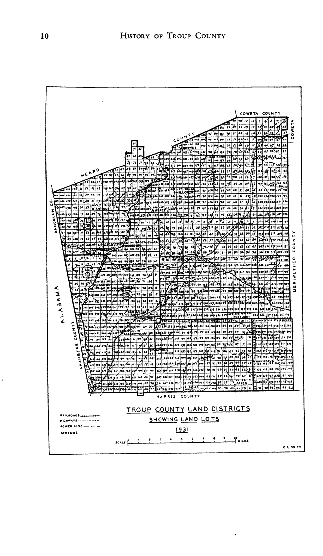
The land districts were laid off with a fair degree of accuracy and the bounding lines of districts closely approximate due east and west, and north and south. The size of a land district is a square of nine miles on each side, 720 chains of sixty-six feet, or a total of 47,520 feet. Those districts adjacent to the Flint and Chattahoochee rivers were modified by the windings of the streams; the Fifth and the Ninth districts of original Troup County were narrow from east to west and were eighteen miles from the north to the south lines; the First district in the southeast corner of the original county was small and contained an Indian Reservation on the Flint River of one square mile, which is now in the present Talbot County.
The land lots were subdivisions of the land districts and were laid off as one-sixteenth of a normal land district side, measuring forty-five chains, or 2970 feet on each side. This subdivision makes two hundred and fifty-six land lots in a normal land district. Careless measurements and the frequent mistaking of line markings have produced many irregularities in the county districts. It must be remembered that the subdivisions were made before the counties were created, and in consequence, a land district may lie in several different counties as at present constituted. The original boundaries of Troup County included all the land lots in the twelve land districts of the Third Section of the survey, lying between the Flint and Chattahoochee rivers, as may be seen from the accompanying map of the original county; but later changes left the Sixth District as the only entire one in the county as at present. This is the district in which LaGrange is situated.
Distribution
Before the counties were created by the General Assembly of Georgia, the land lots of the whole area of five sections as subdivided into sections, land districts and land lots, were distributed by lottery to the citizens of the organized counties of Georgia. The only qualifications for eligibility were three years residence in the state; but revolutionary soldiers’ and those who served in the Indian wars, as well as widows of such soldiers, were entitled to an extra free draw in the land lottery of 1825.
Original Grantees
The land lots were distributed by lottery to the citizens of other older counties, and nearly all of the whole lots were so distributed. The whole lots contained 202½ acres. The undistributed lots and the fractional lots were sold by the state afterwards, some as late as 1850. Some of these original grants were afterwards declared fraudulent by the courts, and the original grant canceled and the lots resold.
- District Grantees
- Third Land District Grantees
- Fourth Land District Grantees
- Fifth Land District Grantees
- Sixth Land District Grantees
- Seventh Land District Grantees
- Eleventh Land District Grantees
- Twelfth Land District Grantees
- Fourteenth Land District Grantees
- Fifteenth Land District Grantees
- Sixteenth Land District Grantees